February 16, 2004
Re-developing Jefferson St.
The Port and the Bay Conservation and Development Commision have chosen plan D to improve pedestrian and bicycle access along Jefferson St.:
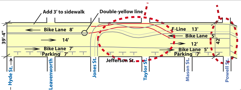
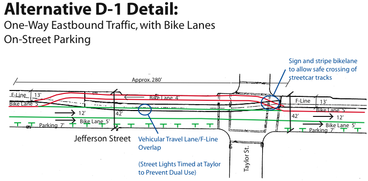
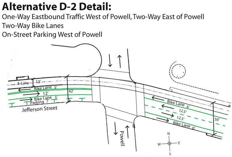
The detail drawings provide a finer view of the interaction of parking spaces, bicycle lanes, and MUNI right-of-way; you'll need your imagination to fill in throngs of wandering tourists at the intersection of Jefferson and Taylor intersection and at the Jefferson and Powell intersection.
The SFBC had endorsed a plan that " ... features (from north to south) a dedicated transit lane for the F-line, westbound bike lane, eastbound travel lane, eastbound bike lane, and parking. This would be the most high profile contra-flow bike lane in the city .... It is very important that we get a large turnout at the meetings because of the importance of a continuous bikeway along SF's waterfront."
Bicycle paths, especially ones used less by commuting cyclists and more by casual riders, such as in the tourist-heavy Fisherman's Wharf area, cause me concern when they need to cross turn lanes. In this case, the MUNI F Line crosses the bicycle lane at Jones. Compounding the difficulty of this stretch of bicycle path is the occasionally-cobbled surface of the street, and the MUNI tracks themselves, a trap for the unawares cyclist.
I biked this road almost every single day that I worked near the Embarcadero: one or two of my co-workers and I would hop on our bicycles and zoom down the Embarcadero bike lane, itself well-planned and -executed, and zip all the way along the waterfront to the base of the Golden Gate Bridge. A quick rest there, and then a sprint back through Crissy Field and a return to our desks within the alloted lunch-hour. Splendid.
